Wednesday, July 7, 2021

Great Western RV National Parks Tour - Days 7 and 8 - Best Friends Animal Sanctuary, Vermilion Cliffs, and Grand Canyon

 Day 7:

 Left Cedar City after a leisurely breakfast and headed for Arizona.  We followed route 14 east, back towards Cedar Breaks and then south on 89 into Kanab, UT.  There we had reserved a rental car for a few hours so we could visit Best Friends Animal Sanctuary, the largest no-kill shelter for companion animals in the country.  Best Friends has a goal of getting to no-kill nationwide by 2025, and their efforts have paid off, as the US has dropped from well over a million euthanasia instances to about 300,000 last year.  When we walked into the visitor’s center, we were greeted by Sven, the greeter cat, who was very friendly and appreciated a good head scratch, and 3 black and white kittens just waiting to be adopted.  All of the animals at the sanctuary (1300-1600) are adoptable – many come from hoarding situations or are surrendered by their owners; they even took in 2 dozen of the dogs from the Michael Vick dogfighting situation (and adopted out almost all of them!).  We were fortunate to grab a spot on a driving tour of the whole sanctuary as soon as we got there and were able to see Dogtown (also a tv series if you want to look it up) and the cat buildings, as well as their facilities for horses, rabbits, pigs and goats.  We had previously booked a tour of the parrot garden, so we met Zeus and Xena, a pair of African grays, and Sugar and Clancy, a bonded pair of cockatoos.  There were many cockatiels and budgies as well, and I can’t forget to mention Daisy, the Moluccan cockatoo who assisted with the beginning of the tour.  She was quite talkative, even if she was more mumbly than articulate, but also very excited to greet us!  After our time at the parrot garden, we hit the cafeteria for a $5 plant-based lunch, and then we drove around a little on our own and found the pigs!  Mom wanted a potbellied pig as a pet for a while, until I showed her how they never stay that small, no matter what the breeders tell you.  Those pigs get to 150-300lbs when full grown, but they are definitely cute when they belong to someone else.  Finally, it was time to get back on the road – we returned the rental car and headed down route 89A into Arizona.  We stopped to take some photos of the Vermilion Cliffs National Monument (no visitor center) and then entered the Navajo Nation on the way to Cameron, AZ.  From there we drove west into the Grand Canyon national park (south rim).  I was driving and trying hard to pay attention to the road, but it was difficult with mom and Margo yelling “holy shit” when they got their first glimpses of the canyon!  I pulled into the next overlook so we could all get a better view, and it really is spectacular.  Words and pictures don’t do it justice – it is just so overwhelming to see it in person!  At over 200 miles long and an average of 10 miles wide, it’s larger than the state of Delaware.  After that we checked into Mather Campground and made dinner inside the RV (no campfires – extreme fire risk) and ate at the picnic table at our site.  We sat there until after dark and while we were hanging out, a female elk just strolled through our campsite about 25 feet away!  Nature is just so awesome!


Day 8:

We slept in a little this morning since we couldn’t run the generator to make coffee until 7am.  After breakfast we walked out to the campground entrance to catch the shuttle bus to the visitor’s center.  We no sooner got there when we saw the signs that the blue shuttle line was not running because of Covid.  So, I hoofed it back to the campsite and got the RV and we drove there instead.   A lot of things here are either closed or operating under revised conditions because of Covid – the neighboring Navajo Nation is still under “yellow” status as far as reopening and still requires masks.  Unfortunately, that meant the visitor’s center at the east end of the park was closed, so we walked out to one of the overlook points and started down the Rim Trail toward the Yavapai Geology Museum, where we could see the full expanse of the canyon on a 3D map, as well as identify all of the different rock layers that have been exposed through the weathering and erosion by the Colorado River over the last 5-6 million years.  We walked the rest of the Rim Trail, following the Trail of Time, which maps out the different types of rock formations in the canyon and how old they are.  We walked 2 billion years of geologic history in a mile and a half.  On a sidenote, it was well into the 90s again today, and it still doesn’t feel like the soupy mess we would be feeling at home. It was hot, for sure, but we had equipped mom with a cooling towel and vest, and that really helped.  We followed the trail to the Verkamp’s visitor’s center, which was open, and then took a few more shots of the canyon, especially the Bright Angel Trail that descends into the canyon.  I can’t imagine hiking a mile down to the bottom, but there were people on it every time we looked.  We found a restroom and a water bottle filler at the El Tovar hotel and then got a quick lunch from the food truck nearby.  While we were eating, we met Irma and Lorraine, sisters who were exploring together.  Irma was 69 years old this year and lives in Brooklyn – she has a host of physical ailments and was wearing a back brace and using a walker, but that didn’t stop her!  I think she wore Lorraine, who was from DC, out.  Maybe we’ll see her around Baltimore someday – her son lives there and she’s thinking about moving since there’s no one left in Brooklyn for her.  After lunch, Margo and I walked back to the first visitor’s center to pick up the RV – mom was too pooped to walk back in the heat.  We took the Greenway bike trail instead of the Rim Trail, which at least had some shade.  When we picked mom up, we drove out to the Desert Watchtower, about 25 miles east of the main village, which we had passed up on the way into the park.  It’s an impressive building, designed by Mary Colter and opened in 1932 – Colter was one of a very small number of female architects working at the time, and was known as the Architect of the Southwest.  The Desert Watchtower is a 70-foot-tall stone tower on the edge of the canyon, and Colter studied many examples of Native American structures before designing the tower, using those examples as inspiration for something completely new.  It’s an impressive structure with a 40-foot-diameter kiva room and a spectacular view of the river at the bottom of the canyon.  From there, it was back to the campsite to relax in the hammock – three more elk walked through! – and make dinner.  Tomorrow we will be on the way to Moab, UT, with, hopefully, a stop at Natural Bridges National Monument.


Sunday, July 4, 2021

Great Western RV National Parks Tour - days 5 and 6

 Day 5:

Saturday was a travel day from Pocatello, ID to Cedar City, UT, over 400 miles of driving.  We didn't have any place in particular planned to stop at, so we just went until we needed to stop for gas, which put us in Ogden, UT, north of Salt Lake City.  After a quick pit stop. we continued south on I-15, which had far more traffic than my mom was comfortable with, even though she wasn't the one driving!  We looked up quilt shops in the area for her and that led us to Provo, home of Brigham Young University.  We had some trouble finding a place to park at first because there was some kind of festival going on, maybe around the 4th, but we finally found a residential street with what looked like college housing.  It was a 5-6 block walk to the quilt store, Harmony, and that was the first exposure we had to high temperatures so far - it was 97 degrees, but only 15% humidity, which is a far cry from what it feels like at home when it's 97 degrees and 95% humidity!  I didn't actually think it was that bad - you know, "It's a dry heat."  She didn't find anything she really liked at that store so we drove about 15 minutes south on route 89 to Springville, UT and found an amazing shop called the Corn Wagon Quilt Co.  This store was 3 floors of fabric and other quilting essentials, so of course she found at least 3 different fabrics she liked.  From there, it was a straight shot down I-15 to Cedar City and we got into the Cedar Breaks RV park around 6:30.  

Day 6:  

Happy 4th!  Today we drove about half an hour to Cedar Breaks National Monument, near Brian Head, UT.  When I first started planning this trip two years ago (canceled last year because of covid) my dad had recommended Cedar Breaks as an alternative to the often overcrowded Zion and Bryce Canyon parks.  It was an excellent choice, as it was not crowded and can stand in as a smaller version of Bryce Canyon.  Cedar Breaks is a natural amphitheater carved by erosion out of limestone, sandstone, and siltstone, with a little manganese thrown in to give some layers a purplish color.  The array of oranges, whites, reds, and purples is stunning, as are the hoodoos, fins, and arches formed by the actions of water and frost wedging over time.  The amphitheater is over 3 miles wide and 2000 feet deep and is at an elevation over 10,000 feet.  Our first stop was at the Chessman Ridge overlook, which is roughly at the middle of the monument.  From there we could see down into the amphitheater and observe all of the colorful rock formations, and as an added bonus, 2 American pika made an appearance out on the rocks.  From there, we went to the picnic area to meet a park ranger intern for a wildflower walk -  the Cedar Breaks Wildflower Festival is happening now, July 2-11.  On this 45 minute walk on the Sunset Trail, we got to see a lovely collection of wildflowers, including elkweed, columbine, larkspur, Aspen bluebells, silvery lupine, little sunflowers, fireweed, scarlet paintbrush, and markagunt penstemon.  After our walk concluded, we headed for the north view overlook for a short geology presentation, also by a ranger intern.  On the way back south, we stopped again at Chessman Ridge so Margo and I could walk the alpine pond trail.  It was 2 miles round-trip, but at 10,467 feet it was a little strenuous.  Our last stop was the makeshift visitor's center (the regular one is under construction at the Point Supreme lookout) and the small gift shop, before heading back to Cedar City to do laundry, as we are now halfway through our trip.  Tomorrow we will head further south to Kanab, UT to visit Best Friends Animal Sanctuary before continuing on to the south rim of the Grand Canyon.


Friday, July 2, 2021

Great Western RV National Parks Tour - Day 4 - Yellowstone National Park, WY to Pocatello, ID via Craters of the Moon National Monument and Preserve

 Day 4:

Up early again this morning, because that's how you beat the masses!  First stop, Mammoth Hot Springs, which was not even 5 minutes from our campsite.  All of Mammoth's distinctive features are formed by hot water, heated by volcanic activity, pushing up through limestone and then depositing calcium carbonate as it runs across the surface.  There's Liberty Cap, a 37 foot tall cone, and Minerva Terrace, a series of ever-changing plateaus, the active ones covered in yellowish-orange thermophilic bacterial mats, an environment that is inhospitable to most other life forms.  We walked all the way up to the upper terraces and then back down again, and then we fired up the generator to make coffee.  Our next stop was the Grand Canyon of the Yellowstone, something Margo and I missed last time.  We started at the overlook for the Lower Falls of the Yellowstone River but couldn't see very well from there, so we found the trailhead to walk down to the bring of the falls overlook, a hike that was only 3/8 of a mile long but dropped 600 feet in the process!  It was well worth it though, to see the falls up close, and to catch a glimpse of the Upper Falls as well.  The walk back up the switchback trail was steep, but not as bad as we thought it might be.  From there, we exited Yellowstone through the West entrance into West Yellowstone, MT and then on to Idaho.  Idaho has about 3x as many residents as Wyoming, but felt almost as desolate at times, when we didn't see much other than cattle and potato fields.  We went a good distance out of our way to visit Craters of the Moon National Monument, between Arco and Carey, ID.  Arco's claim to fame is that it was the first city to be powered entirely by atomic energy, and experiment conducted in the 1950s to show that atomic energy could be used for peaceful purposes.  When we entered the expanse of Craters of the Moon, we could immediately see why it was named as such.  It's 750,000 acres of volcanic rocks, some of which is now covered with lichen and sagebrush, but much of which is still just bare rock.  The visitor's center was small but the displays did a great job of explaining how a hot spot under the North American plate, over the past 16 million years, formed multiple volcanic calderas and lava deposits across the Snake River plain, ending at Yellowstone, where the hot spot is now.  Off and on from 15,000 years ago through just 2000 years ago, lava welled up from the Great Rift, a series of fissures in the ground, forming what is essentially an "ocean of rock".  And it's not finished!  Geologists believe that future eruptions are likely within the next 900 years, but more likely within the next 100 years.  We took the driving tour of the lava fields, spatter cones, cinder cones, and monoliths of rock deposited in the middle of the fields by flowing lava.  We would have loved to have had time to get a permit to go see the lava tube caves, but we wanted to get into the Pocatello KOA before it got too late.  Once at the campground, we had out first experience dumping our sewer tank and gray water tanks - yuck!  Tomorrow is a travel day - 400+ miles to Cedar City, Utah, going through Salt lake City.  We don't have any set plans for where to stop so we'll just see where the day takes up on the way!


Thursday, July 1, 2021

Great Western RV National Parks Tour - Day 3 - Yellowstone National Park, Wyoming

 Day 3:

All Yellowstone, all day!  We were all awake again by the time my alarm went off at 6am, excited to get going, until we realized that we have no electricity here and couldn't start the coffee pot!  Oh well, we'll just have to wait a while.  We drove straight to the Fairy Falls trailhead parking lot and headed for the Grand Prismatic Spring overlook.  We saw the spring from the ground level four years ago and were immediately curious about the overlook platform in the distance, so we found it the next day and got a much better view of its colors.  We wanted to get mom there to see it too, so we hiked the ~2 mile round trip.  Because the air temperature was pretty cool in the morning, there was a lot more steam coming off the spring, so we didn't get to see it in its full glory but we could still see the blue and orange colors, as well as Excelsior geyser beyond the spring.  The Grand Prismatic Spring is the largest in the US and the 3rd largest in the world, at 370 feet in diameter, and well worth the walk to see it from above.  Then it was on to Old Faithful to see one of Yellowstone's best known landmarks, named for the fact that it predictably erupts every 44 minutes to 2 hours.  While we were waiting, we heard a man behind us talking about how he has seen Old Faithful go off 150 times, and in all that time he had only seen the nearby Beehive geyser go off twice.  Beehive eruptions are far less predictable than Old Faithful, with it sometimes going several days without erupting at all.  Best guess from what we heard was every 15-19 hours, give or take 4 hours, so you could easily sit there all day and never see it.  Just as this guy was finishing his conversation, a small geyser, about 6-10 feet high, started erupting near Beehive.  This was Beehive's indicator geyser, telling us that Beehive was actually going to go off within the next 15 minutes - what luck!  Beehive shoots water 200 feet into the sky and carries on for 5 minutes or more, and we got to see it while waiting for Old Faithful, which started to spew as soon as Beehive was finished.  Double bonus!  After checking out the lobby of the Old Faithful Lodge, we found a seat for mom and Margo and I made the 2 mile round trip walk to see Beehive and the other geysers and springs close up.  Once back from our geyser tour, we hit the gift shops and then headed back to the campground so we could enjoy a campfire dinner and s'mores!  Tomorrow morning we will hit Mammoth Hot Springs and the Upper and Lower Falls of the Yellowstone River before moving on to Pocatello, ID for the night.

Note:  check back for photos.  We are still figuring out how to get the camera photos where we want them!


Great Western RV National Parks Tour - day 2 - Lander, WY to Mammoth Campground, Yellowstone National Park, via Grand Tetons National Park and Jackson, WY

 Day 2:

After a decent first night in the RV in Lander, we headed out early and stopped at the Lander Bake Shop for breakfast - mom and I split an excellent peanut butter chocolate chip scone and then each had a breakfast burrito.  Margo had something called "exploding bread" which was like a cinnamon roll but with pesto, parmesan, and mozzarella.  Everything was yummy!  From there we drove towards Dubois, through the Wind River reservation, which is the setting of a series of mysteries that mom reads, so we stopped at the Wind River Trading Company to shop.  Lots of fascinating scenery in Wyoming - such a variety of rock formations, uplifted rock layers, and other geologic features.  There's way more of that than there are people around - Wyoming only has a population of about 578,000, which is less than the city of Washington DC, and it's the least densely populated state in the lower 48.  Then it was straight through to the Moran Junction entrance to Grand Tetons National Park.  After entering the park (thank goodness for mom's lifetime senior pass on this trip - free admission to parks and discounted camping) we decided to head for Jenny Lake and the visitor center there, driving over the Jackson Lake dam on the way.  Unfortunately, Jenny Lake was so jam-packed that cars were parked all the way out the entrance road and onto the main road.  So we skipped it for the time-being and went to Jackson instead.  We parked at the visitor center and walked to the town square - lots of people everywhere, but manageable.  Mom got her picture taken under the arches made of naturally-shed elk antlers and we checked out a few shops, but Margo and I remembered that Moo's Gourmet Ice Cream had made an impression on us last time we were here, so that was a mandatory destination!  Wild huckleberry ice cream - highly recommend it!  After Jackson, we went back north through Grand Tetons, stopping at the Colter bay visitor center, which was far less crowded by late afternoon.  Margo stuck her feet in Jackson Lake and proclaimed it "Cold!".  From there it was further north to the south entrance of Yellowstone National Park.  Margo and I had not been around the southeast section last time, so we drove around West Thumb and Yellowstone lake, the largest high elevation lake (over 7000 ft) in North America (132 square miles,  141 miles of shoreline, average temperature 41 degrees F!).  At Lake Village, we veered north toward Hayden Valley, hoping to see some bison, and we were not disappointed.  We stopped at Mud Volcano and Devil's Breath Spring to see the geothermal activity, and right there, resting by Mud Volcano, not 15 feet away from the fence where we were standing, was a huge bison.  The ranger there said they sometimes like the geothermal features because there are fewer biting insects.  He was not the least bit concerned with everyone watching him!  While we were admiring the steam bellowing from Devil's Breath, it started to rain from the dark cloud overhead, and then it began dropping small hailstones too!  They were only pea-sized, but it was still exciting.  On to Hayden Valley, where we saw two large herds of bison, most of them resting in the meadow.  I was trying to point out to mom where she could see bison calves through the binoculars when other tourists next to us directed us to ones much closer - the moms got us and started moving closer to the herd and their calves popped up out of the grass and frolicked along behind them!  From there we drove straight to our campsite at Mammoth Hot Springs.  Two elk cows strolled through town like they owned the place and once past them we were able to find our site and crash for the night.  We need to be up early to beat the crowds to the Grand Prismatic Spring in the morning.


Great Western RV national parks tour - prequel and day 1

 Prequel:

Margo, mom and I flew to Denver on Sunday, June 27th to stay with my brother, sister-in-law, nephew, and niece until it was time to embark on our journey.  We picked up the 30-foot RV from Cruise America in Federal Heights, Denver on Monday afternoon and spent the rest of the day shopping for provisions, figuring out where to store everything in the cabinets, and practicing driving the thing in the Kohl's parking lot nearby!   We think we're ready to roll!

Bonus feature:  we saw 2 great horned owls sitting on the roof of the neighbor's house! 


Day 1: Broomfield, CO to Lander, WY via Rocky Mountain National Park

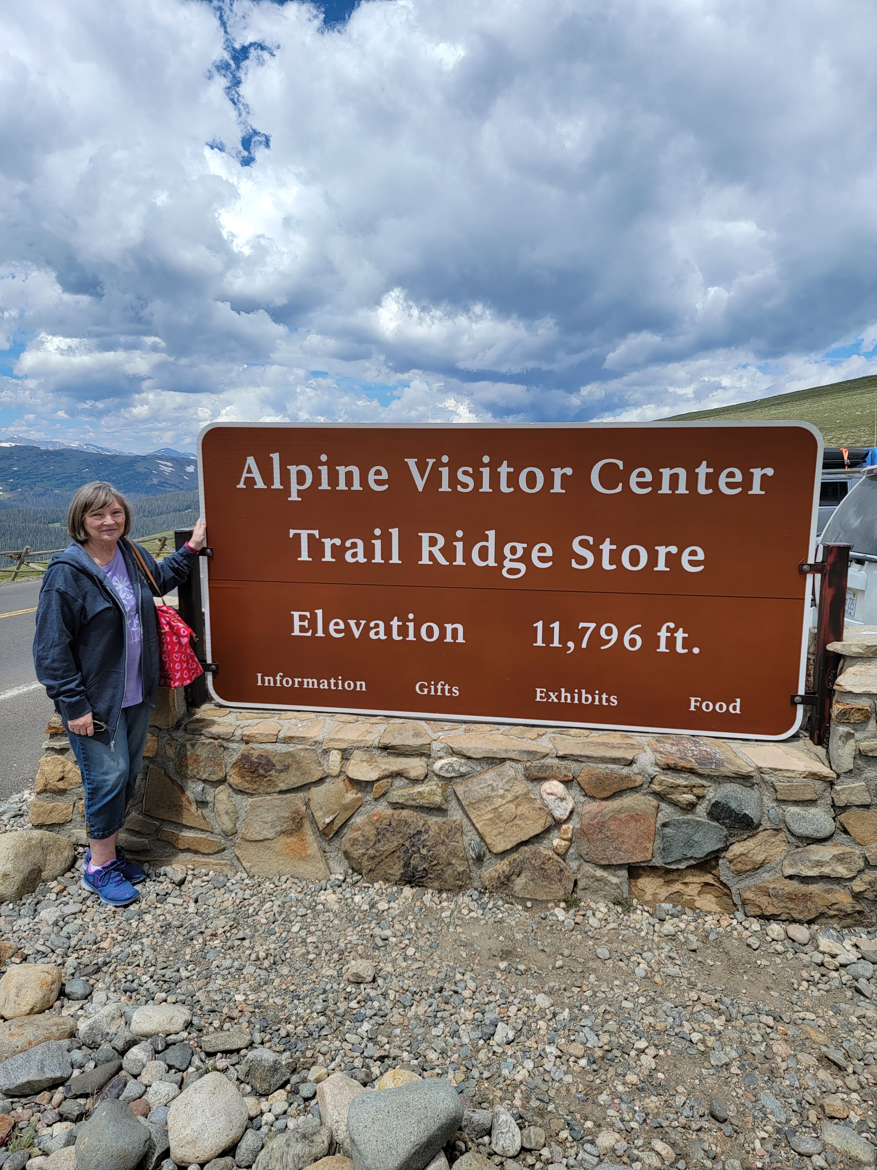
Still on eastern daylight time, we were all awake before the 6am alarm went off.  On the road by 7:15am, we headed for Estes Park, CO.  Once there we went to Kind Coffee for breakfast, met a few friendly dogs and their people, and then walked around town a bit.  Margo saw these wonderful lamps made from fallen aspen tree trunks and we ended up buying one and having it shipped home.  A few more souvenirs later and it was time to head into the park - we had a timed pass to enter between 11am and 1pm, a pilot program started last year to try to manage the number of visitors within the park.  It seemed to us that it worked pretty well because it didn't seem crowded at all, despite all the news stories about the national parks being jammed this summer.  (More on that later...)  We drove up Fall River Road to Trail Ridge Road and kept climbing until we reached the Alpine Visitor's Center at 11,796 ft altitude, stopping once to look over the valley below Many Parks Curve.  After taking in the view from there, we made lunch in the RV before descending Trail Ridge Road on the west side of the mountains.  Trail Ridge Road is closed most of the year because of deep snow and is passable only in the summer months - it was closed as recently as May because of last spring snow.  There are multiple switchback turns on the way down but the RV handled well and we had no problem getting down the other side.  As we approached Grand Lake, CO we could see the devastation from last year's wild fires - acres and acres of burned tree trunks and scarred land.  Oh, and we also stopped to watch a bull elk with gorgeous antlers cross the road in front of us, and later saw a female moose browsing off the side of the road!  Once we reached Granby, CO, it was a long haul to Lander, WY and the Sleeping Bear RV Park and Campground.  We hooked up the electricity and filled the water tank and made our first dinner in the motorhome.  Time to rest up for the drive to Grand Teton National Park in the morning!